Maps
Don Det map (click to enlarge)
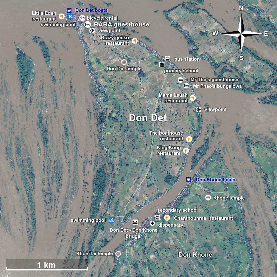
Shape and size of Don Det. A bridge links the twin islands
Don Det and Don Khone.
A bus station
(to the waterfalls) is located near the primary school.
A small medical dispensary (for minor diseases and injuries) is located in Don Khone, a few meters after the bridge.
There is a temple in the middle of the rice fields, near the center.
Two private swimming pools are opened to the public in Don Det.
The
pier and its beach are top north.
Don Det center map (click to enlarge)
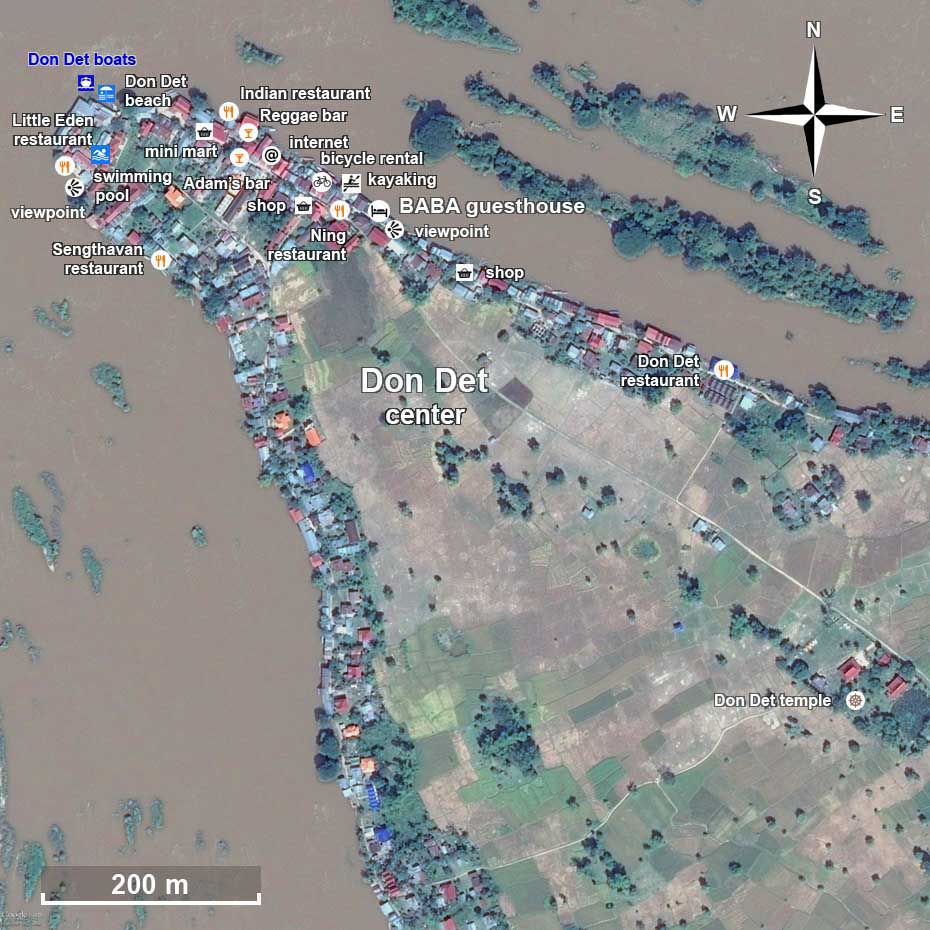
The center of Don Det is located near the pier and the main beach where the
boats come
from / go to Nakasang (main land), Don Khone, Don Som, and other islands.
BABA guesthouse is located
at a viewpoint, in front of an old rain tree facing the Mekong, and behind the green rice fields.
The kayaking tours start next, and there are also
several bicycles rentals near.
Most of the restaurants, bars and shops are settled around.
Don Det + Don Khone map (click to enlarge)
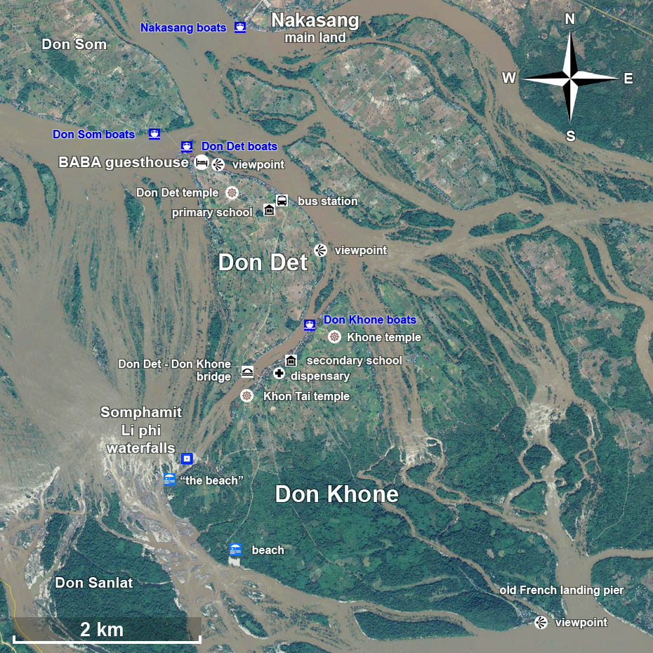
The Somphamit rapids (Liphi falls) are located at about 1,5 km from the bridge between Don Det and Don Khone. Before turning right to the waterfalls, the road goes straight to reach a large and quiet beach of sand, where it is possible to swim. In Don Khone there is also an impressive viewpoint at approximately 4 km from the bridge, following the old rail bed.
The 4000 islands map (click to enlarge)
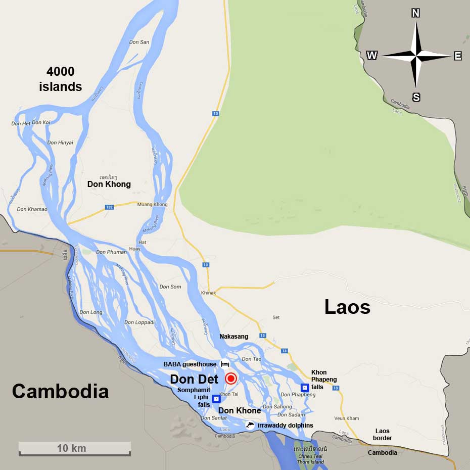
The name Si Phan Don litterally means "Four Thousands Islands", and is 50 km-long. During the raining season, this section of the Mekong fills out to a breadth of 14 km. Don Khong is the biggest island, but the landscapes of Don Det and Don Khone attract more visitors. The Khon Phapheng falls are near the eastern shore of the Mekong, and it is possible to get there by boat from Don Det and Don Khone, by bus or minivan from the main land (Nakasang).
Don Det + Cambodia map (click to enlarge)
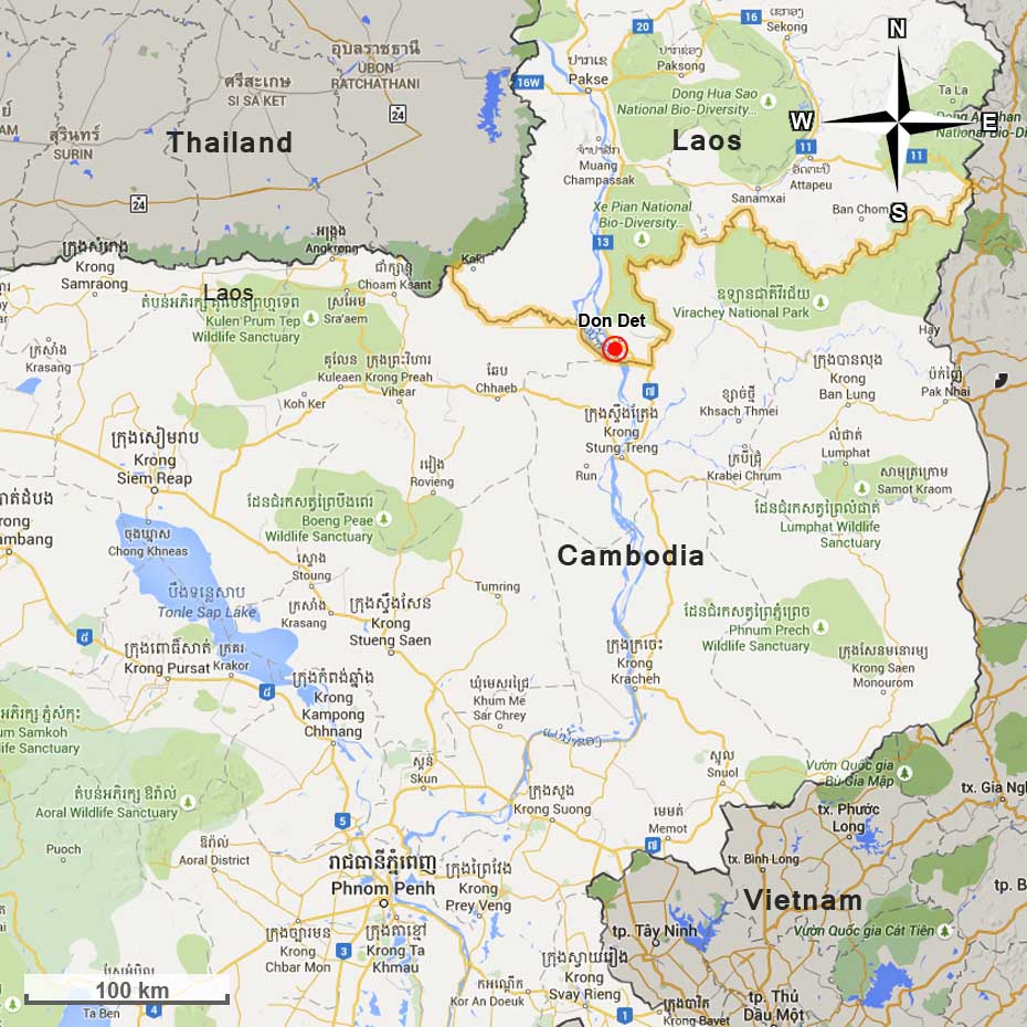
Don Det is located top south of the country, near the cambodian border.
Bus tickets are sold everyday on the island to the main destinations, like Phnom Penh,
Siem Reap, Stung Treng, and the Lao-Cambodian border.
Transport Don Det from/to Cambodia
Don Det + Pakse map (click to enlarge)
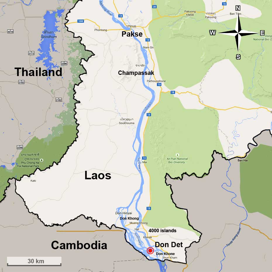
Pakse is 148 km-far from Don Det.
The old archeological site of Champassak is at 40 km from Pakse, and 119 km from the 4000 islands.
Transport Don Det from/to Pakse
Laos map (click to enlarge)
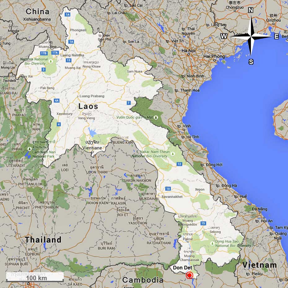
The capital Vientiane is 815 km-far from Don Det.
Transport Don Det from/to Vientiane or Vang Vieng
An interactive map of the country with more details is available on the official Tourism Laos website.


